



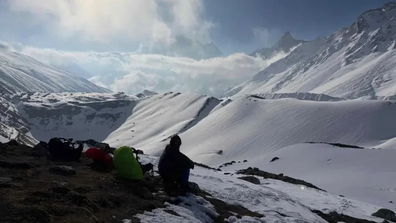
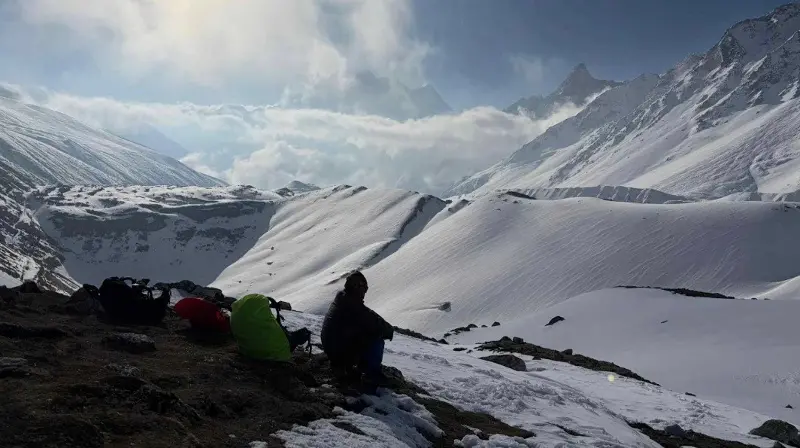
 Sunrise scene on the mountain climbing route to Larke Pass in northern Nepal. (Source: Lorretta Chen)
For most nature lovers , the 12-day Manaslu trek is a true test of physical fitness and endurance. This long hike spans between 130 and 160 km, depending on the chosen route, starting from Machha Khola on the Budhi Gandaki River and gradually heading north, near the Tibetan border.
The highest point of the journey is the Larke Pass at an altitude of 5,106 meters, where the thin air makes every step more difficult than usual. The explorers faced snow, freezing nights, and limited living conditions and food supplies.
However, this very harshness is the price for a rare, unspoiled experience amidst the age of mass tourism . While today's tourists can easily travel by helicopter from Kathmandu to the Everest or Annapurna base camps, Manaslu still retains the slow pace of a traditional exploration journey, where every step must be taken on foot.
Until a decade ago, this trek was nearly impossible without adequate camping equipment. The Manaslu Reserve, through which the route passes, issued fewer than 5,000 permits in 2016. However, since the COVID-19 pandemic, visitor numbers have surged, surpassing 10,000 for the first time in 2024. Even so, this number is still quite modest compared to the trek to Base Camp Everest – the world's most famous trekking route – which attracts over 35,000 visitors annually.
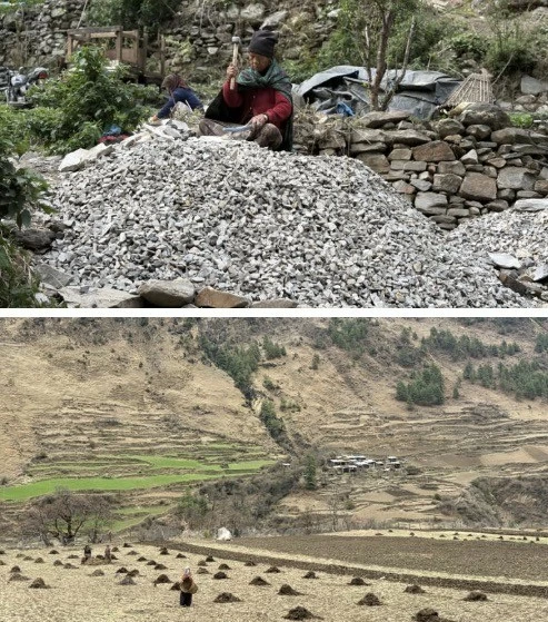
Above photo: Women breaking rocks to make gravel for road construction.
Below: Piles of fertilizer scattered across the field as farmers prepare the land.
All trekkers in Manaslu must be accompanied by a local guide and pay around $100 for a seven-day trekking permit. Even reaching the starting point is not easy: although only about 160 km from Kathmandu, the journey still takes nearly 11 hours along rugged and dusty mountain trails.
According to tourism professionals in Nepal, Manaslu is gaining popularity thanks to social media and the trend of seeking less crowded trekking routes than Everest or Annapurna. However, the area still retains much of the original isolation of the Himalayas.
Hikers often receive support from porters – local porters who can carry 20–50 kg using traditional straps looped around their foreheads to shift the weight onto their necks and backs. Wearing simple shoes, or even flip-flops, they still move nimbly up the steep mountain slopes, outpacing many international tourists struggling to adjust to the altitude.
If you begin your journey from Machha Khola on a misty morning, you may encounter the first signs of tourism development spreading to the area. Dirt and gravel roads are being widened all the way to Jagat village – marking the boundary of the Manaslu Reserve. New guesthouses are springing up alongside the old suspension bridges that were once symbols of Nepalese trekking routes.
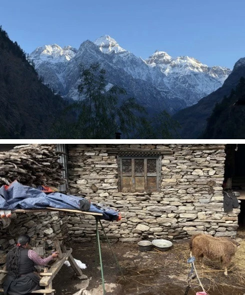
Above photo: Mount Chamar and its surrounding peaks rise above the village of Deng in the morning light.
Below: A Tibetan woman is weaving cloth in her yard next to two yaks in Sama Gaon.
Jagat is also where motorized roads end, giving way to treacherous trails winding along the cliffs. From here, caravans of mules and donkeys carrying goods become the primary means of transport between villages deep in the Himalayas.
The journey becomes increasingly challenging as the altitude increases. Beyond the deep gorges, the landscape of snow-capped peaks begins to appear. The Himalayan scenery unfolds on such a massive scale that humans suddenly feel tiny amidst nature. In Nepal, only mountains over 6,000 meters are truly called "mountains"; anything lower is usually considered just a "hill." The peaks are so densely packed that many remain unnamed on maps.
The cultural imprint of Tibet becomes even more apparent as we venture deeper into the Manaslu highlands. The majority of the inhabitants here follow Tibetan Buddhism and maintain their traditional way of life for generations. Along the way are walls inscribed with Tibetan Buddhist mantras – where visitors often walk clockwise as a ritual to pray for peace before the mountain peaks. Prayer wheels appear at the entrances to villages, alongside images of people plowing fields with yaks and weaving handcrafted fabrics in their yards.
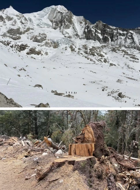
Above photo: View from Larke Pass
Below is a photo of logging activity in the Annapurna region.
The weather in the Himalayas changes extremely rapidly. In just a few hours, hail can turn into heavy snow, temporarily blocking roads through mountain passes. In the Himalayas, weather is always the ultimate deciding factor for any journey.
After days of snow cover, the mountain sky often returns to a breathtakingly clear blue. Meadows where yaks graze peacefully stretch at the foot of the ice-covered peaks. In the distance, the distinctive triangular peak of Manaslu emerges, with its cold, blue glacier flowing down the slopes. Mountain moles and flocks of Himalayan green sheep occasionally appear on the high rocky slopes.
Snow often begins to fall lightly as travelers approach Larke Pass towards the end of the day. For many, the biggest challenge isn't the ascent but the descent, when the melting snow leaves the slopes slippery and dangerous.
Crossing through pine forests interspersed with blooming rhododendrons, the trekking route gradually leads into the Annapurna area – a region that has seen significant tourism growth in recent years. Along the way, large logs lie waiting to be cut for construction materials for new resorts, leaving the bare mountain slopes vulnerable to landslides during the rainy season.
Infrastructure development and tourism have brought significant income to the people of Nepal's mountainous regions. However, along with the new roads and increasing number of guesthouses, a question is also emerging: will the unspoiled natural beauty that once made Manaslu so uniquely attractive remain intact in the future?